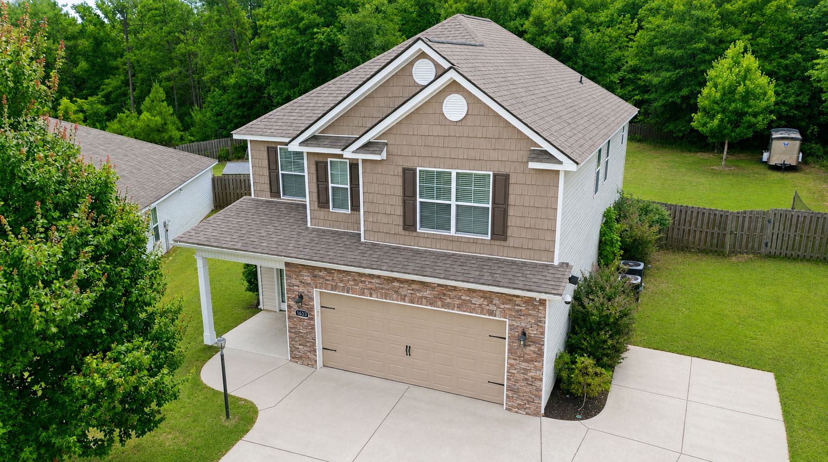
A ground-level photo shows a house. A drone photo shows the whole story — the lot, the setting, the pool, the pond behind the tree line, how the property sits in its neighborhood. That's the context buyers crave, and it's exactly what makes drone real estate photos so effective.
Why Aerial Photos Sell Homes
Buyers don't just buy a house — they buy land, location, and lifestyle. Ground shots can't show any of that at once. Drone photography can.
- Scale and lot size — Nothing communicates acreage, frontage, or a big backyard like an overhead view.
- Setting and surroundings — Waterfront, wooded lots, cul-de-sac privacy, proximity to a golf course or lake — all obvious from the air, invisible from the driveway.
- Standout listings — Aerial shots still make a listing look premium. In a crowded search page, they earn the click.
For larger or higher-value CSRA properties — think acreage in Columbia County, lakefront near Clarks Hill/Thurmond Lake, or homes on the Aiken side with land — aerial photos aren't a luxury, they're the shots that sell the property.
What You Get With a Drone Photography Package
Professional aerial coverage usually includes a mix of:
- Elevated exterior shots that frame the full home and lot
- Wide establishing shots showing the property in its neighborhood
- Boundary and lot-context images so buyers understand where the property lines sit
- Optional aerial boundary overlays — property lines drawn onto the aerial image, which is powerful for land and larger lots
The FAA Rules: Why "Licensed" Matters
Here's what a lot of sellers don't realize: flying a drone to market a home is commercial work, and the FAA requires the pilot to hold a Part 107 Remote Pilot Certificate. This isn't optional, and it's not the same as someone who owns a hobby drone.
A properly licensed operator also handles the rules that keep your listing legit:
- Remote ID — the drone must broadcast its identification, as required by the FAA.
- Airspace authorization (LAANC) — much of the CSRA sits near controlled airspace around Augusta Regional Airport (Bush Field) and Daniel Field. A licensed pilot can request authorization to fly legally in those zones.
- Safe operating limits — flying under 400 feet, in daylight, within visual line of sight, and not over people.
When you hire a licensed operator, you're not just getting better photos — you're making sure your listing's marketing is done by the book.
What Drone Real Estate Photos Cost
Aerial photography is typically an add-on to a photo package or bundled into a full listing media package. Pricing depends on the size of the property and how many aerial shots you need. For most listings, a handful of well-composed aerial images is plenty; for land and estate properties, it's worth doing more.
When to Add Drone to Your Listing
Drone shots make the biggest difference for:
- Homes on larger lots or acreage
- Waterfront and lakefront properties
- Homes near golf courses, parks, or notable amenities
- New construction and neighborhoods where the community is a selling point
- Any listing where you want to stand out on the search page
For a small city lot with neighbors close on both sides, aerial may add less — and we'll tell you honestly when that's the case.
Frequently Asked Questions
Do you need a license for drone real estate photos? Yes. Marketing a home is commercial work, so the pilot must hold an FAA Part 107 Remote Pilot Certificate. Always confirm your photographer is licensed.
Can you fly a drone anywhere in the CSRA? Not without checking airspace. Areas near Augusta Regional Airport and Daniel Field are controlled airspace that require FAA authorization (LAANC). A licensed pilot handles this for you.
How much do drone real estate photos cost? It's usually an add-on to a photo package or part of a full listing media bundle. Cost scales with property size and number of shots — contact us for a quote.
Is drone photography worth it for a small home? For a small city lot, sometimes standard exterior photos are enough. Drone shines on larger lots, waterfront, and properties where the setting is a selling point.
Add Aerial to Your Next Listing
Show buyers the whole story. Book with us to add licensed drone photography to your CSRA listing.